Proposed Memorials

The Completed Projects 2017-2018

1. Steilacoom-3 sites:
Steilacoom Historical Museum Association-Voyage of Discovery
Pioneer Park- Historic Waters
Saltars Point Park- Crossroads of Discovery

2.. Vancouver Notch: Washington State Committee on Geographic Names Approved Proposal on October 23, 2015
On 1 December 2015, The Washington State Department of Natural Resources Board approved Vancouver Notch as an official name. The US Board on Geographic Names denied my Proposal based on new coordinates which put the feature in a Wilderness Area. January 3, 2017, the WA Board rescinded its approval to denial status.


Sunday, October 27, 2013

Kopachuck and Cutts Island State Park Re-Visited

9 October 2013
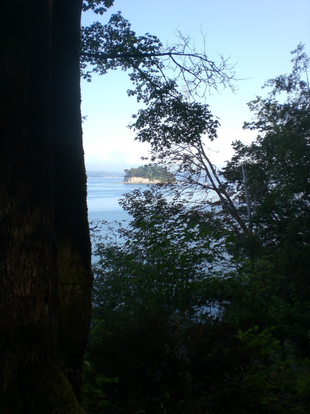
I met again with Park Ranger Dennis Mills at Kopachuck to review possible sites for future signage for the Puget Memorial Project. Dennis drove me down on the park road to view several sites. The last two seemed the best and the last one was my favorite, as it has a clear view of Cutts Island and is near the waters edge at high tide.
Ranger Mills pointing to Cutts Island


He brought me up to date with next years signage for Cutts Island.  They are adding another post to the existing signage post. They will be 5 feet apart and will house a  metal  Cutts Island Sign, a Wa State Park sign and  smaller signs for no fires,etc. There would be room to put an 18x24 inch sign for Puget. Having a metal sign might work for Cutts.

Current sign post

This would be removed


not all signs will be 18x24
This is not the parks' plan, but my drawing for me to think about.


This certainly got me thinking that a cheaper, smaller Cutts Island sign might be a possibility. Even adding one on Kopachuck would work. Dennis showed me current Kopachuck signs that are 18x24 inches:
The green sign is 18x24 in.

This is 18x24 in


I departed with a fresher sense of new possibilities. This might be a more practical approach and one in which we could dove-tail with the park on something that could happen faster than at Blake Island. I also like that Kopachuck has a virtual Geo-Cache program for the park and perhaps this could be incorporated into our signage, as well. Thank you, Dennis for your time, thoughts, vision and your support for the Puget Memorial Project.


Wednesday, October 2, 2013

Anderson Island and Richard Blumenthal

28 September 2013

Days of relentless storms marched across the southern waters of Puget Sound. I sat in my car waiting for the Anderson Island Ferry to load. As I looked out through the torrents of rain and pea soup fog I could not see beyond the Ferry Terminal at Steilacoom, WA. Hidden from my eyes was my destination for the afternoon, Anderson Island. Nothing was going to stop this ferry ride for me. I was about to meet Richard Blumenthal, my mentor, the man who infused my spirit to follow my dream of replicating Lt. Peter Puget's Exploration of the Southern Arm of these waters we know as Puget Sound. He was speaking to the Anderson Island Historical Society and Dave Jacobsen, President had invited me. Dave is also on the Anderson Island Parks Commission. Our journey together began in May 2013, when he invited me to see the new beginning of Jacob's Point Park which overlooks Oro Bay. Oro Bay is where Puget and his party took refuge from a storm on 22 May, 1792. A storm similar to my storm today.

My journey with Richard(Dick) began in February 2012, when learning that all the authors of my reference books were deceased, I took a chance and called a number and a live person responded, and yes, he was the author of my favorite reference book, With Vancouver in Inland Washington Waters. We spoke for an exciting hour. I had a million questions and he had a million answers. He confirmed that Puget took Blake Island to port, but the starting point(anchorage) was illusive, but somewhere between Blake Island and Restoration Point on Bainbridge Island. He had replicated the route in his own boat.


Since that time I have emailed him on a regular basis, but I had never received any replies. He is a busy author and compiling another book, Maritime Place Names- Inland Washington Waters. Today, I would meet him and hear him speak on his newly published book.


Left-Dave Jacobsen; Right- Richard Blumenthal


The islanders put on a wonderful pot luck dinner and Dick spoke for an hour on the various Anderson Island names and Puget's route into Oro Bay. I discovered my email address was incorrect, and he never received my emails.  He is such a knowledgeable and fun man to speak with. Our circle of friends is growing and more and more people are getting excited about Blumenthal's books, Jacob's Point and the Puget Memorial Project, which now includes Anderson Island residents.
Andreas Anderson, Dave and myself
enjoy the friendly islander hospitality


Dave told me he is traveling this week to the Big Island of Hawaii and will be replicating Archibal Menzies' route to ascend the slopes to the summit of Mauna Loa. Oh my gosh! This will be exciting to hear about.

Please go to this link to see all the books Richard Blumenthal has written. Inland Waters Publishing, buy some for Christmas presents, birthdays or whatever. This was wonderful to be on Anderson Island again, and absolutely fabulous to meet Richard Blumenthal and to hear him speak about Puget Sound. A love we all have in common. My circle of friends has just gotten more spectacular. Thank you Dick, Dave, and the Members of the Anderson Island Historical Society.

Thursday, September 12, 2013

Cutts Island State Park

22, 23 August 2013

I make a quick trip to Cutts Island to look closer at Memorial sites. Site possibilities are limited to say the least. The upper levels of the flat top section of the island are reached by a slippery steep trail head coming off the beach. The trail which leads to the upper section has poison oak. While some people do make it to the top, most stay on the low tide beaches. At the highest of tides there is a small portion at the North side that never goes under water. Here the park has signage for no fires and seal habitat. There is another post cemented into the shore which does not have a sign. Perhaps this can be used? Installation has its own set of problems; beaching a work boat, carrying water for cementing posts, vandalism is a concern as there is little park ranger visitations to the island. In speaking with several island visitors, they all say in spite of a no fires sign, fires do exist on a regular basis.
Minus tide showing the northern land spit reaching to Raft Island.

High bluff on south side
North side is possible site

This post is above high water mark.

Possible site

Trailhead to Flat top section of island

Sand spit leading to signage(white)

Saturday, August 10, 2013

Kopuchuck State Park

Following my Rotary Club Talk in Gig Harbor I drove over to Kopuchuck State Park which over looks Cutts Island State Park. The Park Commissioners wanted me to consider this park as a Plan "B" in the event Cutts can not be used.

I hiked down to the water's edge to see the view of Cutts Island. This is my favorite view. Afterwards I spoke with the Ranger in charge of both parks.  Kopuchuck Park has more visitors than Cutts Island. This could definitely be a site. Ranger Dennis tells me there is a flat place on the top of the island on Cutts in which a memorial could be placed. There is a steep climb which might  limit the size of the project and the installation.

He also stated we could be thinking of becoming involved in the park's Virtual Geo-Cache program. Rather than finding a cache, one would find something on the reader board/memorial to verify the GPS finding. In the case of Cutts Island, perhaps the words Eating Crow, as Puget called Cutts Island, Crow Island for the plentiful supply of crow, which they shot, ate and enjoyed.

My next cruise will be back to Cutts Island and visit the inner parts of the island to determine a site.
Cutts Island off in the distance
A nice site for our Memorial

Kopuchuck State Park--Reader Board without a view of Cutts


A remote Viewing Site--not frequented

Gig Harbor Rotary Meeting- Peter Puget Memorial Project

I have anticipated this talk for months now and on Friday 9 Aug at 0700 hrs I was attending my first Rotary Meeting with my Host Dick Vanberg. I have never seen so many happy people this early in the morning before in my life. They were such a friendly group that it seemed to quiet my nerves. I, too, was having as much fun as they were.

Dick and Jean Vanberg with Hira aka Peter Puget


I had to make me a Peter Puget summer uniform as my fleece uniform would have way too hot. The talk went really well and it was well accepted. We now have many new "friends" to add to our list. Thank you Gig Harbor Rotary.


Tuesday, June 4, 2013

4 June 1792 The Most Historic Day in the Voyage of Discovery

4 June 2013 Tuesday

Shatoosh, Pashmina and Hira Barbara Reid have departed the historic anchorage of the HMS Discovery at Blake Island and headed north following in their wake up into Possession Sound. Both the HMS Chatham and the Discovery are piloting, surveying and map mapping. Mr Whidbey is exploring the island that becomes Whidbey Island. Alot is happening, the Chatham runs aground in Port Susan,and gets off without damage, but today is a day of rest for all the men.

4 June 1792- Edmond Meany quotes Captain George Vancouver," all the men were served as good a dinner as we were able to provide for them, with double allowance of grog to drink the King's health, it being the anniversary of HIS Majesty's birth; on which auspicious day, I had long since designated to take formal possession of all the countries we had lately been employed in exploring, in the name of, and for HIS Britannic Majesty, his heirs and successors.

To execute this purpose, accompanied by Mr.Broughton and some of the officers, I went on shore about one o'clock, pursuing the usual formalities which are generally observed on such occasions, and under the discharge of a royal salute from the vessels, took possession accordingly of the coast, from that part of New Albion, in the latitude of 39 degrees 20 minutes north, and longitude 236 degrees 26 minutes east, to the entrance of this inlet of the sea, said to be supposed straits of Juan de Fuca; as likewise all coast islands,etc.within the said straits, as well as on the northern as on the southern shores; together with those situated in the southern quarters; which interior sea I have honored with the name of the Gulf of Georgia, and the continent binding the said gulf, and extending southward to the 45th degree of north latitude, with that of New Georgia; in honor of His present Majesty. This branch of Admiralty Inlet obtained the name of Possession Sound; its western arm, after Vice Admiral Sir Alan Gardner, is distinguished by the name of Port Gardner and its smaller eastern one by that of Port Susan.( his wife)."

King George III was born in 1738 and reigned 60 years.

Saturday, June 1, 2013

Blake Island St. Park Commissioners

30 May 2013

Today was a milestone, as the WA State Park Commissioners from Olympia arrived by boat to take a look at site possibilities for the Puget Memorial. Shatoosh and Hira arrived the day before to be ready for discussions and examining options.
l to r.
David Roe, Paul  Ruppert, Nikki Fields, Michael Hankinson, Ryan Karlson, Ed Girard.


We, collectively narrowed 5 possible sites to 2 and focused on them, comparing the pros and cons. The first one is at the Entrance Head Sign and is in a prime location for easy viewing and gets lots of traffic. The trail is flat and stable for persons with disabilities. The HMS Discovery Anchorage has limited viewing due to the marina and breakwater. Restoration Point is directly across the harbor entrance.This existing signage would be removed and placed at another location.


The second one in near the corner of Tillicum Village and is equally visited by the Argosy Tours guests. This would need coordination with another company and leveling out the trail. It requires more work however the Anchorage site is easier to view. The site has native Indian totems and brings us closer to the time period of Puget and evokes feelings of antiquity.


It is exciting to work with these talented, bright people who recognize the importance of Puget's role in the historic exploration of the southern waters. It is a laborious task that we are embarking upon, and our target date of installation and dedication will have to be delayed. We remain focused and determined to see this through.