Proposed Memorials

The Completed Projects 2017-2018

1. Steilacoom-3 sites:
Steilacoom Historical Museum Association-Voyage of Discovery
Pioneer Park- Historic Waters
Saltars Point Park- Crossroads of Discovery

2.. Vancouver Notch: Washington State Committee on Geographic Names Approved Proposal on October 23, 2015
On 1 December 2015, The Washington State Department of Natural Resources Board approved Vancouver Notch as an official name. The US Board on Geographic Names denied my Proposal based on new coordinates which put the feature in a Wilderness Area. January 3, 2017, the WA Board rescinded its approval to denial status.


Saturday, December 21, 2013

Merry Christmas 2013 to Our New Friends

This month terminates the year end efforts of The Peter Puget Memorial Project. Skip Dreps and I began and ended the year at the Washington State Capitol. This has been quite a year starting up and building a foundation for the project to be launched.
                                                                                                                                                                              

Skip Dreps has been hard at work in the halls of the state capitol and to date he has gained support from the Association of Washington Generals. A few days ago we met with Senator Jim Honeyford to discuss legislation for the Project. Skip will orchestrate this next big aspect. The NW Chapter of the Paralyzed Veterans Association will support our "Fund Raising" efforts.

Barbara( Hira) has been busy "Friend Raising" and has collected quite a number of like minded individuals/organizations who believe in the Lt. Peter Puget Memorial Project. We would like to thank the following organizations/ people who have been very supportive in listening to and helping in spreading our message: Honor, Memorialize and Celebrate Lt. Peter Puget and his Exploration Party.

Gareth Curtiss- Artist for Project- His work is inspiring to all who see it.
The Washington State Parks Recreation Agency- Blake, Cutts and Kopachuck State Parks- Peter Herzog, Assist Director, The WSPR Commissioners/ Planners/ Park Rangers.
The Tacoma Waterfront Assn- Sue Schaeffer/ Roger Williams/ Dick Ramsey
The Tacoma Yacht Club- Commodore Charlie Long
The Tacoma Women's Sailing Assn- President Cheryl  Bertha
The Tacoma Library NW Room- Vancouver Voyage of Discovery
The Gig Harbor Rotary Club- Dick Van Berg
The Anderson Island Historical Society- Dave Jacobsen
The Anderson Island Parks Commission- Jacob's Point Park
The British Consul- Robin Twyman for Business and Government Affairs
The Foss Waterway Seaport Museum- Joseph Govednik
The Browns Point Lighthouse- Jim Harnish and Mavis Stears
Anne and Laurence Yeadon-Jones of the Dreamspeaker Guides.
Richard Blumenthal- Author, Historian of Washington Waters- exploration/naming- He launched my own voyage with his knowledge of Peter Puget and Captain Vancouver.
Deb Wallace- Airport and Ferry Administrator Pierce County- Gig Harbor Rotary
John and Pat Lantz- Gig Harbor Rotary and WSPR Commission
Too Tall Tom- crew on board Shatoosh for our replication of Puget's exploration.

It has been a memorable year getting to meet so many supportive and enthusiastic people. I want to thank all the boaters on all the docks whom I have met and spoken to, and from all my blog readers from around the world. We are all learning about The Voyage of Discovery and Lt. Peter Puget's exploration of the southern waters. I also want to thank all my friends, relatives who support me on a regular basis in this journey. There is still lots to do to complete this project, so stay tuned.


Thursday, November 28, 2013

Captain George Vancouver and the Abrupt Division

The Peter Puget Memorial Project blog was created to honor, memorialize and celebrate Peter Puget's exploration of the southern waters. While I have purposefully not blogged about Captain Vancouver's own exploration in the eastern and southern waters, the time has come to share one aspect that intrigues and interests me. This interest is turning into a spin-off project within the project.

I became intrigued in general about the eloquent writing found in  the journals written by Vancouver, Puget, and Menzies. I marveled at the detail of some of the observations and descriptions they penned while under the most difficult conditions of severe storms, rain, cold, heat, late at night  in the cramped quarters of a small tent on shore with only a candle burning or below the decks of the HMS Discovery with a hundred other men.

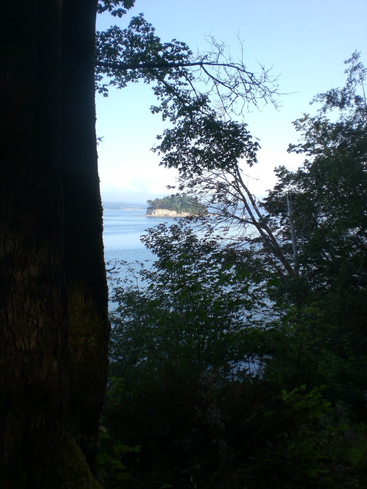
On May 20, 1792 Captain Vancouver had the HMS Discovery anchored near Restoration Point on Bainbridge Island. From this vantage point he saw Mt Baker to the north and Mt Rainier to the south and observed an interesting geological formation along the southern slope of Mt. Rainier. During the next week he made several references in his log about the very conspicuous and abrupt division in the snowy range of mountains immediately to the south of Mt. Rainier. He speculated the eastern inlet of Commencement Bay stretched in that direction.

On May 26, 1792, Captain Vancouver with 2 launches began their exploration of the eastern waters of Commencement Bay. He wrote, "Towards noon we landed on a point on the eastern shore, whose latitude I observed to be 47° 21′, round which we flattered ourselves we should find the inlet take an extensive eastwardly course. This conjecture was supported by the appearance of a very abrupt division in the snowy range of mountains immediately to the south of mount Rainier, which was very conspicuous from the ship, and the main arm of the inlet appearing to stretch in that direction from the point we were then upon. We here dined,[Browns Point] and although our repast was soon concluded, the delay was irksome, as we were excessively anxious to ascertain the truth, of which we were not long held in suspense. For having passed round the point, we found the inlet to terminate here in an extensive circular, compact bay. [Commencement Bay], whose waters washed the base of Mount Rainier, though its elevated summit was yet at a very considerable distance from the shore, with which it was connected by several ridges of hills rising towards it with gradual ascent and much regularity. The forest trees, and the several shades of verdure that covered the hills, gradually decreasing in point of beauty, until they became invisible; when the perpetual clothing of snow commenced, which seemed to for a horizontal line from the north to south along this range of rugged mountains, from whose summit Mount Rainier rose conspicuously, and seemed as much elevated above them as they were above the level of the sea; the whole producing a most grand, picturesque effect. The lower mountains as the descended to the right and left, became gradually relieved of their frigid garment; and as they approached the fertile woodland region that binds the shores of this inlet in every direction, produced a pleasing variety." p.138, 139 Edmond S. Meany, Vancouver's Discovery of Puget Sound, The Macmillan Company, 1907.

After having read about this conspicuous and very abrupt division, I wondered what might this formation be. Could we see it today? I waited for a clear day to see this location myself. As I looked south and east from Commencement Bay and Restoration Point as Captain Vancouver did in 1792, we can see and appreciate today what he described.   There is an abrupt division in the foothills, creating a v-shaped notch. After all these years of my not being aware of it, it is just as Vancouver described.
2013


As I looked at this abrupt division I wondered, what information might this geographic division hold?  Where was this division geographically located? What river flowed through such a divide, was it the Nisqually or was it the Puyallup? I had my bet on the Nisqually River emptying into the Nisqually Reach in the southern arm, as it is a larger river system and farther south of Mt. Rainier. I wondered if it had ever been officially named, if not, perhaps I could officially have it named. I have been calling it  Vancouver’s Notch for several months so, perhaps we could use that name?

Unlike Vancouver, whose job it was to document and chart, plot and interpret land masses and waterways, we cruise through life and the waterways on auto pilot. If this abrupt division was enough to get Captain Vancouver’s attention, perhaps I could step up to the challenge and find answers to my own questions and eventually educate other Puget Sounders.

I am collaborating with Richard Blumenthal, the author of many historical books relating to Puget Sound exploration and naming of places. We have been in a week long discussion as he educates me regarding the rules and procedures of officially naming  a place. I am learning that this is a journey in itself. I see that I have jump-started the process and have the cart before my horse. I need to know what this division is: is it a space- a gap, a pass, a mountain summit or a ridge? Before you can name a place, you have to know what the place is and where it is.  After this week of exploring the area, looking at Google Earth and topographical maps, I do have some answers to my questions and also have more questions.

Answers:
1. This region is not in a wilderness area, but is in the Mt Baker-Snoqualmie National Forest which borders Mt. Rainier National Park on its southwest side. It is located in Pierce County, WA. One cannot name sites in a wilderness area.
2. The 45 mile long Puyallup River is the river that courses through this division. It originates from the Puyallup and Tahoma Glaciers, its tributaries are the Mowich, the Carbon and the White Rivers and empties into Commencement Bay.
3. According to the Geographic Names Information System (GNIS) there are 2 mountain areas in this vicinity that are officially named.
          a. Puyallup Point is a summit with elevation 5305 ft. located in map name: Mt Wow. Coordinates(DMS): 465017N, 1215637W
          b.The Divide is a ridge with elevation of 3986 ft. located in map name: Le Dout Creek.
Coordinates(DMS): 465320N, 1220406W

More Questions:
1. Now realizing The Divide is a ridge rather than a summit. Is The Divide a part of Vancouver's abrupt division? We have to make certain The Divide is the ridge that we are looking at when we see Vancouver's Notch, as I am calling it.
2. Richard Blumenthal has done some more research and has shed  light onto our process. He makes a great statement in another email to me. " If the notch is part of The Divide (i.e., the valley between two of its peaks), there is nothing wrong with an additional name, e.g., Vancouver Division, which is part of The Divide. Think of Snoqualmie Pass as part of the Cascade Range."

Next Steps:
1. Fly the area to document these structures in their relationship to the visual abrupt division as described by Vancouver. Get the coordinates of the visual division and compare them to the named structures. I am working on getting cost quotes.

2. Consider Official Names.for the space between the ranges/mountains/ridges: Vancouver Notch, Vancouver Divide, Vancouver Division,Vancouver Pass. There is a class name of a notch, therefore perhaps I could name this location as I have been calling it, Vancouver Notch. Richard informed me that  ('s) have to be deleted. We learned this when Vancouver named  Puget's Sound, which was changed to Puget Sound.

We all can honor Captain Vancouver by naming the abrupt division after him. He was the first to write a description about it in his log, there is evidence on his master chart/map of this area of a division, and John Sykes drew a sketch of Mt Rainier which shows the notch very clearly.
Vancouver's Chart/Map

First Picture of Mount Rainier from Admiralty Inlet
Drawn by W. Alexander from a sketch by J. Sykes, 1792. Engraved by J. Landseer for Vancouver's Journal.
 

1903 photo from Lake Washington Mercer Island showing notch


 Vancouver named Mount Rainier
for
Rear Admiral Peter Rainier


Thun Airfield Pierce County showing notch 2013


 Even today as the TV weather cams photograph sunrise on Mt. Rainier you can see Vancouver's abrupt division. So next time you are out cruising Puget Sound, look for Vancouver's Notch, as I call it and send me a picture.


Sunday, October 27, 2013

Anderson Island

26 October 2013

The Anderson Island Historical Society invited Barbara Reid to give a presentation at their monthly pot luck dinner and talk. Dave Jacobsen, President and numerous members made certain flyers were sent out to island residents/clubs, all the AV setup worked, the food was delicious and there was a big turnout for a small island.  They were interested in hearing my personal replication of Puget's route into the southern waters in May of 1792.
Anderson Island Community Center


Special Guests were Deb Wallace and her husband, John. Deb is the Administrator for Pierce County Ferries and Airports and is interested in our Puget Project. She had attended my talk to the Gig Harbor Rotary. Her department is working on having historians speak about the local area on special Ferry Routes that are being created in the south sound.. I am looking forward to meeting with Deb for future collaboration.

I continue to be so impressed with the Anderson Island community and what they are doing for their island.
Their own project with creating Jacob's Park is continuing to develop and a composting toilet has been placed, a walkway down to the beach is being constructed, giving kayakers access to the point, park and facilities.

For me personally, this was my best talk of the year. I continue to be at more ease with my audience, I am having more fun, and am learning more about how interested people are in this topic. I feel I am making a big soup for Puget Sound and as time passes, the soup is simmering more and more and getting better and better. There are more friends to meet, more talks to give, more ideas to sort through and more fun to be had.
PS... Yes, I wore my Puget outfit, but I am back in my winter uniform as fall in in the air and the leaves are turning red/gold and the pumpkins are ripe for Halloween.

Kopachuck and Cutts Island State Park Re-Visited

9 October 2013
I met again with Park Ranger Dennis Mills at Kopachuck to review possible sites for future signage for the Puget Memorial Project. Dennis drove me down on the park road to view several sites. The last two seemed the best and the last one was my favorite, as it has a clear view of Cutts Island and is near the waters edge at high tide.
Ranger Mills pointing to Cutts Island


He brought me up to date with next years signage for Cutts Island.  They are adding another post to the existing signage post. They will be 5 feet apart and will house a  metal  Cutts Island Sign, a Wa State Park sign and  smaller signs for no fires,etc. There would be room to put an 18x24 inch sign for Puget. Having a metal sign might work for Cutts.

Current sign post

This would be removed


not all signs will be 18x24
This is not the parks' plan, but my drawing for me to think about.


This certainly got me thinking that a cheaper, smaller Cutts Island sign might be a possibility. Even adding one on Kopachuck would work. Dennis showed me current Kopachuck signs that are 18x24 inches:
The green sign is 18x24 in.

This is 18x24 in


I departed with a fresher sense of new possibilities. This might be a more practical approach and one in which we could dove-tail with the park on something that could happen faster than at Blake Island. I also like that Kopachuck has a virtual Geo-Cache program for the park and perhaps this could be incorporated into our signage, as well. Thank you, Dennis for your time, thoughts, vision and your support for the Puget Memorial Project.


Wednesday, October 2, 2013

Anderson Island and Richard Blumenthal

28 September 2013

Days of relentless storms marched across the southern waters of Puget Sound. I sat in my car waiting for the Anderson Island Ferry to load. As I looked out through the torrents of rain and pea soup fog I could not see beyond the Ferry Terminal at Steilacoom, WA. Hidden from my eyes was my destination for the afternoon, Anderson Island. Nothing was going to stop this ferry ride for me. I was about to meet Richard Blumenthal, my mentor, the man who infused my spirit to follow my dream of replicating Lt. Peter Puget's Exploration of the Southern Arm of these waters we know as Puget Sound. He was speaking to the Anderson Island Historical Society and Dave Jacobsen, President had invited me. Dave is also on the Anderson Island Parks Commission. Our journey together began in May 2013, when he invited me to see the new beginning of Jacob's Point Park which overlooks Oro Bay. Oro Bay is where Puget and his party took refuge from a storm on 22 May, 1792. A storm similar to my storm today.

My journey with Richard(Dick) began in February 2012, when learning that all the authors of my reference books were deceased, I took a chance and called a number and a live person responded, and yes, he was the author of my favorite reference book, With Vancouver in Inland Washington Waters. We spoke for an exciting hour. I had a million questions and he had a million answers. He confirmed that Puget took Blake Island to port, but the starting point(anchorage) was illusive, but somewhere between Blake Island and Restoration Point on Bainbridge Island. He had replicated the route in his own boat.


Since that time I have emailed him on a regular basis, but I had never received any replies. He is a busy author and compiling another book, Maritime Place Names- Inland Washington Waters. Today, I would meet him and hear him speak on his newly published book.


Left-Dave Jacobsen; Right- Richard Blumenthal


The islanders put on a wonderful pot luck dinner and Dick spoke for an hour on the various Anderson Island names and Puget's route into Oro Bay. I discovered my email address was incorrect, and he never received my emails.  He is such a knowledgeable and fun man to speak with. Our circle of friends is growing and more and more people are getting excited about Blumenthal's books, Jacob's Point and the Puget Memorial Project, which now includes Anderson Island residents.
Andreas Anderson, Dave and myself
enjoy the friendly islander hospitality


Dave told me he is traveling this week to the Big Island of Hawaii and will be replicating Archibal Menzies' route to ascend the slopes to the summit of Mauna Loa. Oh my gosh! This will be exciting to hear about.

Please go to this link to see all the books Richard Blumenthal has written. Inland Waters Publishing, buy some for Christmas presents, birthdays or whatever. This was wonderful to be on Anderson Island again, and absolutely fabulous to meet Richard Blumenthal and to hear him speak about Puget Sound. A love we all have in common. My circle of friends has just gotten more spectacular. Thank you Dick, Dave, and the Members of the Anderson Island Historical Society.

Thursday, September 12, 2013

Cutts Island State Park

22, 23 August 2013

I make a quick trip to Cutts Island to look closer at Memorial sites. Site possibilities are limited to say the least. The upper levels of the flat top section of the island are reached by a slippery steep trail head coming off the beach. The trail which leads to the upper section has poison oak. While some people do make it to the top, most stay on the low tide beaches. At the highest of tides there is a small portion at the North side that never goes under water. Here the park has signage for no fires and seal habitat. There is another post cemented into the shore which does not have a sign. Perhaps this can be used? Installation has its own set of problems; beaching a work boat, carrying water for cementing posts, vandalism is a concern as there is little park ranger visitations to the island. In speaking with several island visitors, they all say in spite of a no fires sign, fires do exist on a regular basis.
Minus tide showing the northern land spit reaching to Raft Island.

High bluff on south side
North side is possible site

This post is above high water mark.

Possible site

Trailhead to Flat top section of island

Sand spit leading to signage(white)

Saturday, August 10, 2013

Kopuchuck State Park

Following my Rotary Club Talk in Gig Harbor I drove over to Kopuchuck State Park which over looks Cutts Island State Park. The Park Commissioners wanted me to consider this park as a Plan "B" in the event Cutts can not be used.

I hiked down to the water's edge to see the view of Cutts Island. This is my favorite view. Afterwards I spoke with the Ranger in charge of both parks.  Kopuchuck Park has more visitors than Cutts Island. This could definitely be a site. Ranger Dennis tells me there is a flat place on the top of the island on Cutts in which a memorial could be placed. There is a steep climb which might  limit the size of the project and the installation.

He also stated we could be thinking of becoming involved in the park's Virtual Geo-Cache program. Rather than finding a cache, one would find something on the reader board/memorial to verify the GPS finding. In the case of Cutts Island, perhaps the words Eating Crow, as Puget called Cutts Island, Crow Island for the plentiful supply of crow, which they shot, ate and enjoyed.

My next cruise will be back to Cutts Island and visit the inner parts of the island to determine a site.
Cutts Island off in the distance
A nice site for our Memorial

Kopuchuck State Park--Reader Board without a view of Cutts


A remote Viewing Site--not frequented

Gig Harbor Rotary Meeting- Peter Puget Memorial Project

I have anticipated this talk for months now and on Friday 9 Aug at 0700 hrs I was attending my first Rotary Meeting with my Host Dick Vanberg. I have never seen so many happy people this early in the morning before in my life. They were such a friendly group that it seemed to quiet my nerves. I, too, was having as much fun as they were.

Dick and Jean Vanberg with Hira aka Peter Puget


I had to make me a Peter Puget summer uniform as my fleece uniform would have way too hot. The talk went really well and it was well accepted. We now have many new "friends" to add to our list. Thank you Gig Harbor Rotary.


Tuesday, June 4, 2013

4 June 1792 The Most Historic Day in the Voyage of Discovery

4 June 2013 Tuesday

Shatoosh, Pashmina and Hira Barbara Reid have departed the historic anchorage of the HMS Discovery at Blake Island and headed north following in their wake up into Possession Sound. Both the HMS Chatham and the Discovery are piloting, surveying and map mapping. Mr Whidbey is exploring the island that becomes Whidbey Island. Alot is happening, the Chatham runs aground in Port Susan,and gets off without damage, but today is a day of rest for all the men.

4 June 1792- Edmond Meany quotes Captain George Vancouver," all the men were served as good a dinner as we were able to provide for them, with double allowance of grog to drink the King's health, it being the anniversary of HIS Majesty's birth; on which auspicious day, I had long since designated to take formal possession of all the countries we had lately been employed in exploring, in the name of, and for HIS Britannic Majesty, his heirs and successors.

To execute this purpose, accompanied by Mr.Broughton and some of the officers, I went on shore about one o'clock, pursuing the usual formalities which are generally observed on such occasions, and under the discharge of a royal salute from the vessels, took possession accordingly of the coast, from that part of New Albion, in the latitude of 39 degrees 20 minutes north, and longitude 236 degrees 26 minutes east, to the entrance of this inlet of the sea, said to be supposed straits of Juan de Fuca; as likewise all coast islands,etc.within the said straits, as well as on the northern as on the southern shores; together with those situated in the southern quarters; which interior sea I have honored with the name of the Gulf of Georgia, and the continent binding the said gulf, and extending southward to the 45th degree of north latitude, with that of New Georgia; in honor of His present Majesty. This branch of Admiralty Inlet obtained the name of Possession Sound; its western arm, after Vice Admiral Sir Alan Gardner, is distinguished by the name of Port Gardner and its smaller eastern one by that of Port Susan.( his wife)."

King George III was born in 1738 and reigned 60 years.

Saturday, June 1, 2013

Blake Island St. Park Commissioners

30 May 2013

Today was a milestone, as the WA State Park Commissioners from Olympia arrived by boat to take a look at site possibilities for the Puget Memorial. Shatoosh and Hira arrived the day before to be ready for discussions and examining options.
l to r.
David Roe, Paul  Ruppert, Nikki Fields, Michael Hankinson, Ryan Karlson, Ed Girard.


We, collectively narrowed 5 possible sites to 2 and focused on them, comparing the pros and cons. The first one is at the Entrance Head Sign and is in a prime location for easy viewing and gets lots of traffic. The trail is flat and stable for persons with disabilities. The HMS Discovery Anchorage has limited viewing due to the marina and breakwater. Restoration Point is directly across the harbor entrance.This existing signage would be removed and placed at another location.


The second one in near the corner of Tillicum Village and is equally visited by the Argosy Tours guests. This would need coordination with another company and leveling out the trail. It requires more work however the Anchorage site is easier to view. The site has native Indian totems and brings us closer to the time period of Puget and evokes feelings of antiquity.


It is exciting to work with these talented, bright people who recognize the importance of Puget's role in the historic exploration of the southern waters. It is a laborious task that we are embarking upon, and our target date of installation and dedication will have to be delayed. We remain focused and determined to see this through.

Saturday, May 18, 2013

Anderson Island and the Puget Memorial Project

I received an exciting email from Dave Jacobson on Anderson Island. He is a Park Commissioner on the island and he ran across our Memorial blog. The Park Commissioners invited me over yesterday to see their new project, Jacobs Point Park, and  to talk about their newly discovered information of Peter Puget's encampment on Anderson Island - 22 May 1792 and how that might impact their project.
Arriving Anderson Island on the
MV Christine Anderson, a Pierce County Ferry
17 May 2013


Anderson Island has always been known for their well documented history through several authors over the centuries of in-habitation since the mid 1800's. Dave is also the President of the Historical Society and his parents owned property on the island long ago. As he mentioned to a friend, we are just now discovering our island people date back to 1792 with the Puget Exploration Party. The 5 Commissioners are very excited to have discovered this information at this particular time. TheCommissioners are Dave Jacobson, Bill Spears, Rick Anderson, Chuck Hinds and Carol Pascal. They are well into developing an 85 acre park with 2.5 miles of trails and picnic/viewing sites(5) on the Jacobs Peninsula which extends into Oro Bay. Oro Bay is where the Puget party took refuge from a SE storm and were forced to spend the night. Indians came in 3 canoes and brought them salmon, berries and traded bear skins with the explorers.

click to enlarge


We hiked the newly created trail to Jacobs Point and looked out over Oro Bay to the bay's southern shoreline and land spit where we believe the explorers camped based on the Journals of Peter Puget and Archibald Menzies which were edited by Richard Blumenthal.(With Vancouver in Inland Washington Waters) Afterwards Dave and his wife, Lynn took me to their home and we had a wonderful lunch.
An Amazing Group of Commissioners
& Supporters.


Oro Bay from Jacobs Point


I am really excited about Jacobs Point Park and the Commissioner's plan to add the "Puget" component to their signage as well as, to their island history. This is a perfect example of my dream. Share the information of the Puget Exploration of the Sound and let each Puget Sounder bring him to life in their own life and the life of their community/organization/or project. Let us all Honor, Memorialize, and Celebrate Peter Puget and his Exploration Party. Thank you Anderson Island for stepping up to the plate, becoming a friend of ours so, we all can make our projects memorable and project them into the lives of the next generation. We don't want to loose Peter Puget again, now that we have re-discovered him. It is interesting that King George III named the 1791-1795 voyage, the Voyage of Discovery. 221 years later, we are still discovering these explorers again and finding new and wonderful  places and ways to honor them.  Anderson Island could have an annual party/ picnic to honor the Puget Party on 22 May of each year. What a magical process!


Tuesday, May 14, 2013

Coins and Coining

Skip Dreps took me to the Burien Office of the NW PVA to meet his long time friend, Ernie Butler, Executive Director and to pick up a coin so that I could take it and "coin" Robin Twyman, the British Consul who is supporting our Puget Memorial Project.

The NW Chapter of the PVA is a Puget Memorial Project Endorser. It was an honor to finally meet Ernie. He is a fantastic man, a paraylyzed veteran and a fellow Viet Nam Veteran who changes lives every day.

Front View

Rear View


"Coining" has become quite the tradition in the military. It was an honor to "coin" Robin and introduce him to this long time tradition. This was Robin's first coin and my first time in coining someone. A great day for both of us.

To read more about the PVA click here
NWPVA

Monday, May 13, 2013

New Friends of the Project

May is a busy month for the Puget Memorial Project as numerous connections, meetings are taking place and  new friendships are being formed.


On 6 May 2013 I had the Great Opportunity to meet with Robin Twyman, Consul (Business and Government Affairs) UK Government Office, Seattle, WA. The meeting took place on the 41st floor overlooking the western views of Puget Sound and the Olympic Mountain range. If that wasn't enough it was the sunniest and warmest day of the year. I briefed Consul Twyman on our Memorial Project, its importance in our joint histories, its way to honor our shared heroes and its path to secure remembrance for future generations.  He stated, "I am very interested in this project which celebrates Britain's long and prosperous relationship with Puget Sound and I want to be kept informed of its progress." Consul Twyman accepted my invitation to join us at the Dedication Day.

On 8 May 2013 I spoke at the Monthly Meeting of the Tacoma Waterfront Assn. The venue was at the prestigious Tacoma Museum of Glass.


The talk was well received by many and I ran into an old friend who I knew and worked with in the 70-80's.
The Tacoma Waterfront Assn is made up of many businesses who promote activities along the Tacoma shoreline. They have recently obtained permission to have a seaplane dock on the Foss Waterway which will allow commercial and private sea planes to land. The TWA has become a great friend of the Puget Memorial Project.

On 11 May 2013 another friend of the Project re-opened their doors to the public after a year and a half renovation: The Foss Waterway Seaport Museum. I visited it and the new Glass Frontage is spectacular. I'm told at night it is spectacular.

Seaport Museum

Welcome

Nice canoe

Woody with Chris Craft in Tow

Wow rear view of Chris Craft.

Gas inboard


I spent an hour poking my nose around and ran into some TWA folks I knew. Joseph Govednik who is in charge of Exhibitions has done a beautiful job with the set-up. The old warehouse is huge and capable of expansion. I visualized Peter Puget Exploration as being next year's new exhibit. This Museum is accessible by boat and within walking distance to the Museum of Glass. You should make it a destination.

Thursday, March 28, 2013

Another Curtiss Memorial

A couple of days ago I was driving south on I-5 to go to Shatoosh, my Albin 25. As I passed Camp Murray, a Tacoma National Guard Armory, the sun was shining and was beaming on the Minuteman, one of Gareth Curtiss' Memorials. I have passed this stretch millions of time, but today was my first sighting of this historic statue. The light on the patina was stunning. On my return trip I stopped to take a closer look.


Maquette that Gareth gave me.


The statue must be 8 feet tall, and is breath taking. The attention to detail is most noteworthy. I can't wait to see what Gareth has in his creative head and heart and know deep within my own heart, that future generations will come by boat and by car to view our Memorials to Lt. Peter Puget and they will stand in the sun and honor the man for whom the Sound was named.